Pages

Friday, 4 March 2011

Grindelwald to Zermatt Day Two - Wengen to Murren

At 10km Wengen to Murren is a shorter day and was made even shorter thanks to the train. I know - cheating already!

Wengen
Looking across the Lauterbrunnen Valley towards Murren from Wengen. The village lies on the shelf above the cliffs.


Eiger Monch and Jungfrau
Three Peaks - The Eiger, Monch and Jungfrau from the path between Grutschalp and Murren.


Trail to Murren The trail here is one of the easiest walks anywhere - let alone somewhere with views such as these. A relaxation day after the Eiger Trail and before the Sefinenfurke but if you wish to walk the whole way from Wengen you must first descend nearly 500m/1640ft to Lauterbrunnen then climb a steep 700m to reach this nice easy section. If you just walk from Grutschalp to Murren it is only 4km to walk with a gentle 150m of ascent.

The longer version follows the line of the railway then the gondola and while the distance added is only 6km, it is a lot of additional climbing. On a cooler day - maybe - but with 34 degrees Celsius - that's about 93 in old money - threatened for the valley I'm not ashamed to say that I took the gondola to Grutschalp and walked from there. Some people went by train all the way to Murren which is just plain lazy!
Back to day 1 >>> Grindelwald to Wengen
On to day 3 >>> Murren to Griesalp

Grindelwald to Zermatt - Walking From the Eiger to the Matterhorn

During the summer of 2007 I set out to walk through the Swiss Alps from Grindelwald beneath the North Face of the Eiger to Zermatt at the foot of the Matterhorn. It is a journey that certainly lived up to expectations though I did deviate somewhat from the planned route on a couple of occasions. My experiences on the walk itself can be read about in detail in A Long Walk in the Alps which was published the following year and the route would appeal to any who are looking to do a long distance Alpine trek without the crowds you can meet on the better known routes such as the Haute Route and the Tour du Mont Blanc. It is not too far from the tourist trail though and accommodation is plentiful along the way.

Why did I pick Grindelwald to Zermatt then? Well - they were both places that I had visited several times previously and they both stand beneath mountain peaks of World renown surrounded by some of the most spectacular scenery in Europe. It was the idea of linking these Alpine regions and the 2 mountains - the Eiger and the Matterhorn - that really inspired the route. A more accomplished climber would climb the peaks but as I would be just as likely to fall off one of them I decided to begin with the Eiger trail and finish with the Matterhorn Trail - the 2 walkers paths associated with them.

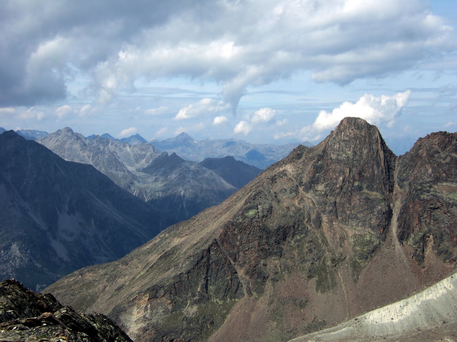
This post is a photo diary of the route - the one actually followed as opposed to the one I should have followed - but I have added information on the intended route where they differ. The walk took me eight days to Zermatt with another day to walk the Matterhorn Trail (which you can do in an afternoon} though as the way is not set in stone like many of the more popular treks, there is plenty of scope to vary the route according to weather conditions or personal preferences.

Thanks to everyone who bought A Long Walk in the Alps - I hope you enjoyed it. I certainly enjoyed doing the route though some parts were hard work because of the weather.

Pete Buckley Mar 2011

The full story is available for download or free preview in both the US and UK Kindle stores while the photo diary of Grindelwald to Zermatt follows here - navigation is at the end of each post. For more e-reader formats please visit Smashwords.

Day One: Grindelwald to Wengen via the Eiger Trail


Grindelwald Walking down the road from the Hotel Lauberhorn towards Grindelwald one is greeted with views such as this - the Fiescherhorn (4049m) on the left and the Eiger (3970m) completely dominate this valley.


The Eiger Trail The Eiger Trail footpath frpm Alpiglen (1616m) begins over a pleasant meadow with the immense crags of the North Face looming overhead. The route heads through the trees ahead before doubling back to the right below the face.


Schilthorn and Kleine Scheidegg Higher up the trail crosses some extremely pleasant open country which is unseen from below. The snow capped peak above the saddle is the Schilthorn (2970m).


Eiger North Wall Above on the left the Eiger makes its prescence felt. The North Face is 1800m or 5900 feet of near vertical limestone rising to the summit of the Eiger.


Wetterhorn from Eigertrail Nearing the top of the Eiger Trail route the view back is truly spectacular with Grindelwald far down to the left and the Grosse Scheidegg pass beyond. The peaks are the Schwarzhorn (2927m) and the Wetterhorn (3692m)


Eigergletscher
The view over the far side isn't bad either! A fine lunch spot where I was accompanied by a dog (not pictured) taking shelter from the sun. The building below is the Eigergletscher station of the Jungfrau Railway (2320m)while across the Lauterbrunnen valley which is a vertical mile below, Murren - next day's destination - can just be made out below the prominent peak of the Schilthorn (snow - just right of centre) while the obvious col to its left is the Sefinenfurke pass where we leave the Jungfrau Region.


Eiger and Monch The Eiger (3970m) and the Monch (4099m) from the easy path down past Wengernalp (1874m) which is a good place to stop for a drink or something to eat. Here you will encounter many tourists who have not just hiked up the Eiger Trail but have instead simply got off the train at Kleine Scheidegg and walked down. Never mind - I saw a golden eagle as well!


jungfrau alpenglow An hotel balcony, a beer and a view like this - cool! Evening alpenglow on the Jungfrau (4158m) from wengen while below is the Lauterbrunnen valley with the Breithorn at its head.

This section has well marked trails all the way with a total distance from Alpiglen to Wengen of 14km (9 miles) with just over 700m (2300ft) of ascent and 1050m (3400ft) of descent. Alpiglen is a request stop on the Jungfrau Railway. Walking from Grindelwald would make this a long day carrying a backpack.
Day 2 >>> Wengen to Murren (mostly by train)

Friday, 25 February 2011

The Oberrothorn - Switzerland's Highest Walkers' Peak

At an impressive 3415m or 11204ft the Oberrothorn is the highest peak in the Swiss Alps with a marked hiking trail to its summit. Apart from altitude there is no difficulty in the ascent - the slightly lower Mettelhorn across the valley being the more challenging - and it may be climbed from any of the gondola stations on the lift system known as the Rothorn Paradise which leaves Sunegga. You could even make the ascent from Zermatt but it's a long way up from there - over 6000 feet or 1800m.

Do not do as the author did and do this on the first day in Zermatt - much dizziness above 3000m - a couple of days in these high hills is a good idea before venturing to this height. The route between the two "Rothorns" is known locally as the Weg zur Freiheit or Freedom Path but don't take my word on that as I can't speak German. The pictures are from early July 2006


Looking down to Zermatt from the Rothorn gondola station which is on the Unterrothorn peak at 3101m. Starting from here is the easiest way to the top of the Oberrothorn but for a longer walk set out from Blauherd (middle station on gondola) or Sunnegga (funicular from Zermatt) where easy and well signed paths lead up to the col between the 2 peaks.


The Oberrothorn from the Unterrothorn. The way leads down to the col at the bottom of the picture and follows the path visible around the lower right side of the peak.


Rimpfischhorn and Strahlhorn The path ascends without difficulty from the col around to the far side of the peak where it zig zags up a steep shale slope. The view from here is of the Rimpfischhorn (the sharp central peak) and the Strahlhorn on the right. Both are Alpine 4000 Metre Peaks and the upper part of the Saastal lies beyond them.


Mischabel from Oberrothorn The far side of the Oberrothorn is not so easy and drops away precipitously. Care is needed if there are cornices but the way here is easy over snow and shale. Those who are not acclimatized you will notice the lack of air on the ascent!


Oberrothorn summit The curious monument on the Oberrothorn summit at 3415m. The Matterhorn is supposed to be in view straight ahead here but the weather was not co-operating while the "eye" monument marks the end of the Weg Zur Freiheit. The way down is a simple retracing of one's steps back to the col between the 2 peaks. From there take the path that heads left down the slope instead of returning to the Unterrothorn. It soon widens and follows a high valley downwards through alpine meadows to Blauherd at about 2500m. Many marmots inhabit this section of the route.

Pete Buckley Feb 2011
For the full account of this trip please see my Oberrothorn page on Travellerspoint

Friday, 4 February 2011

The Faulhorn from Grindelwald

Easily reached from the First gondola, the Faulhorn is quite deservedly a popular ascent from Grindelwald with the route passing the beautiful Bachsee en route to the summit where the walker will be rewarded by breathtaking views of the snowy Oberland peaks across the valley.

This route involves a little over 500m of ascent with 900m of descent and is about 8km in distance. To make it easier, return to First instead of descending to Bussalp or for a longer walk leave the gondola earlier and walk to First. Walking from Grindelwald would involve over 1600m (5250ft) of ascent - something I would not recommend on a warm summer's day! For the full account of this walk please see my Faulhorn entry on travellerspoint.faulhorn_ascent_route
An easy path leads from the First Gondola station towards Bachsee which is in the hollow ahead. The Faulhorn (2681m) is identifiable at the head of the valley by the building on the summit which is the Berghotel Faulhorn.


fiescherhorn_eiger The Fiescherhorn (4049m) and the Eiger (3970m) seen from the early part of the route.


hikers_on_the_faulhorn Hikers approach the Gassenboden col (2553m) with the Bachsee visible down to the right. For some bizarre reason my camera did not take the photo I took of the Schreckhorn reflected in the Bachsee which is a classic view so it's not on here. It is however on plenty of other sites - or you can go there to see it - which is much better. The peak beyond in this photo is the Schwarzhorn (2927m).


eiger_monch_jungfrau As the path reaches the Gassenboden col you are rewarded for your efforts with this wonderful view of the Eiger, Monch and Jungfrau.


berghotel_faulhorn Then you are reminded that there's still a little way to go. A wide easy path makes its way up to the summit of the Faulhorn.


faulhorn_summit The Faulhorn summit at 2681m (8796ft) and a typically Swiss scene with the flag flying. The views over the other side are not bad either!


brienzersee To the North lies the Brienzersee which is over 2200m (7200ft) below and is backed by the Alpine foothills.


Back at Gassenboden a path turns off steeply down over the far side of the col. It is still easy but rather rougher than the way we came up.


faulhorn The way leads down through a pleasant backcountry that seems wild compared to the busier path from First. In this view we're looking back up towards the Faulhorn with the Berghotel just visible on the summit.


bussalp Looking down to Bussalp from the lower part of the path. The first buildings are known as Oberlager and the mountain path here becomes a wide farm track that leads to Mittellager.


postbus All these references to lager were making me thirsty so I opted to catch the bus down from Bussalp to Grindelwald where I could partake without facing a long walk afterwards. The Eiger is the mountainin the background.

Pete Buckley Feb 2011

Friday, 14 January 2011

Hohsaas and the Weissmies Hut

This route which visits the Weissmies Hut and the newly inaugurated high altitude hiking trail the Hohsaas Rundweg, begins at Kreuzboden which is reached by cable car from saas Grund in the Saastal. While the route could (theoretically but not by the author) be done from the valley without using the gondola it would be excessively long. As it is there are about 930m (3050ft) of ascent and the distance is not excessive. Paths are well marked, often steep, but never difficult and the gondola gives an easy way down if needed.

The views of the peaks of Saas Fee and the close up prospect of the Trift Glacier are the highlights of the walk with the high alpine zone being reached with surprising ease but don't try it straight from the valley on your first day in the Alps - the altitude of over 3300m is cosiderable. There are more walking routes on my homepage.

kreuzboden
Kreuzboden is situated at 2400m in fantastic walkers' country in a hollow in the mountains high above the Saastal. This route sets off from here towards the peaks of the Fletschhorn and the Lagginhorn. The route is easy and well marked.


saas_fee
From above Kreuzboden the distant village of Saas Fee comes into view below the snowy Alphubel and the clouded Mishchabel peaks. The towers on the left hand slope are the line of the Hohsaas cableway which is useful in descent.


weissmies_hut_and_the_jagihorn
The Weissmies Hut at 2726m is reached by a final; steep section of path though there is no difficulty getting here. The rock peak is the Jagihorn (3206m) and is popular with climbers.


weissmies_hut
The path ascends the stony slopes behind the hut to reach a rocky cwm beneath the Lagginhorn and Fletschhorn where it turns steeply right to climb to a high bleak looking valley where the Hohsaas top station comes into view ahead. The path is easy to follow all the way and the first sign of civilisation reached above this valley is the Berghutte Hohsaas or Hohsaas Hut at 3101m with the gondola station just beyond. If the hut is closed refreshments are available by the station.


jagihorn
The Jagihorn and the sea of peaks to the North West from near Berghutte Hohsaas.


hohsaas
The Hohsaas Rundweg is a fairly new high altitude circular trail leading over the mountainside above the Hohsaas station which is here seen below. The path is again well marked and passes several carved stones which are each dedicated to the 4000m peaks visible from here (weather permitting). You will encounter more people on this short section as many walk the route from the cable car and if you have walked all the way - be smug.


hohsaas_rundweg
The highest point of the trail at 3330m or almost 11000 feet is fittingly marked with the stone representing the Dom - at 4545m the highest Swiss peak not shared with the Italians. It is in the cloud opposite and I didn't actually see it despite this being one of the best days weather wise!


weissmies
Just beyond the high point of the Rundweg the trail passes a small tarn in a rocky hollow and begins its descent back round to Hohsaas. The Weissmies (4023m) and the Triftgletscher or Trift Glacier are most impressive from here.


trift_glacier
After a rough but easy descent the path joins a wide and level track back to Hohsaas. The views of the glacier are quite spectacular. You can return on the gondola or walk back down to Kreuzboden.
Pete Buckley Jan 2011

Friday, 7 January 2011

The Hohtalligrat from Zermatt

The Hohtalligrat is a short but exciting walkers' route from the Gornergrat station to the minor peak of the Hohtalli at 3286m or 10781 feet, which is crowned by a cable car station visible from below. This lift is to transport skiers and does not operate in the summer season so the way to it is along an airy ridge of about 2km in each direction.

The Gornergrat Mountain Railway is a popular excursion from Zermatt and journeys at a leisurely pace from the pinewoods of the Mattertal through the meadows of Riffelberg to the harsh high alpine world above 3000m. The views from the Hohtalli surpass even that World Renowned panorama from the Gornergrat itself and as most of the tourists do not stray far from the safety of the train station they are to be enjoyed in relative peace. The Matterhorn and the Dent Blanche across the valley are especially memorable while this must be the best vantage point from which to view the arctic landscape of Monte Rosa and Liskamm.

As for the route, it involves only a short ascent (little more than 200m) with about 4km of walking for the return journey from Gornergrat but bear in mind that it is a high altitude trail. My previous visit here - also in July - encountered deep snow which can turn the walk into a minor expedition! The way is rough and involves use of the hands in a few places but no hard scrambling is encountered and even the author did not require the services of a helicopter to get down.


gornergrat
After leaving the station (3090m) and skirting the Gornergrat Kulm Hotel and the silver dome of the observatory on the left, the path leaves the buildings and heads towards the Hohtalli which is seen ahead. The high summit just to its left is the Rimpfischhorn (4199m).


hohtalligrat The route soon ascends to the right to easily gain the ridge of the Hohtalligrat and in a dip after this point a path leads off down to the right. This leads to the Monte Rosa Hut but our route is straight on along a track which gets fainter than this one here but is always easy to follow.


gornergrat Looking back to the Gornergrat from the early part of the route with the Matterhorn beyond.


hohtalligrat The trail crosses patches of snow as it leaves the ridge crest on its northern side. This one needed some care but there was a fixed rope up near the rocks to the right.


breithorn Looking back down the latter part of the ridge with the Breithorn and Klein Matterhorn visible on the left of the picture. After this point the path crosses again to the northern side and a rough stony ascent leads to the top.


hohtalli The cable car station on the Hohtalli at 3286m with the Dent Blanche and Obergabelhorn beyond. There were no tourists - the lift only operates in the ski season. The last part to it is again steep and rough but poses no difficulty.


hohtalli Further along the ridge is the Stockhorn but the way beyond here stops being just a walk! The snowy horizon is the Italian frontier with Monte Rosa on the right.


liskamm Liskamm (4479m) and the Grenz Glacier. The Monte rosa Hut is just above the small tarn at the bottom of the picture.


dent_blanche_matterhorn The Matterhorn (4478m) and the Dent Blanche (4357m) are viewed to perfection from here. The Gornergrat Observatory is visible on the left and the way back is to retrace one's steps.
Pete Buckley Jan 2010

Wednesday, 5 January 2011

The Schilthorn from Murren

At 2970m or 9745ft the Schilthorn is one of the highest walkers' peaks in the Jungfrau Region. The summit is attainable by cable car which gives an easy ride down if legs or the weather deem it necessary yet the walk from Murren or Almendhubel provides the walker with an introduction to the high mountains and a route which well shows the transition from lush forests to the harsh alpine world at nearly 10 000 feet. The route too is largely easy and safe. This photo account is from July 2007 when I experienced less than perfect weather with snow on the route yet nowhere did it seem dangerous. From Allmendhubel the route is just over 6km (4 miles) one way with 1060m (3480ft) of ascent. The full account of this trip is available on my walking in the alps archive.murren Allmendhubel at 1912m is a short ride on the funicular from Murren and a good start point for this walk. Add 270m of ascent if starting in Murren. The route is well waymarked for Schilthorn and/or Schilthorn Hut.


The first part of the route is a steep track which leaves the steep slopes vis this gully (not difficult) to emerge on more open and gently sloping pastures below the Schilthorn Hut (2432m) where refreshments are available. The path to the hut branches off to the left a little further on.

birg_schilthorn The route climbs steadily to where the main trail also branches left - as can be seen - to cross the mountainside leading to the cable car station of Birg at 2677m which is on the small peak where the towers are. We don't want to go that way though unless you've had enough or the weather is bad - instead there is a signpost at the top of a slope which directs towards the Schilthorn and the path carries on up the slope ahead.


mountain_tarn Soon the mountain tarn of Grauseeli appears in a fine setting in a hollow in the mountains down to the left as a wide track is followed towards the Schilthorn which rises ahead.


The trail becomes a rough path and climbs the stony slopes ahead generally bearing round to the left to ascend a steep ridge to a subsidiary top high above the valley. The way up involves short easy scrambles with a few chains for protection though even in the snow it was not difficult. The views are wonderful - when you can see them!


The exciting ridge crossing to the main peak with 2 walkers descending it. This was fun rather than scary as there are cables and metal posts for protection. It is fairly narrow but not long though the view of the valley 7000 feet down on the left adds drama. The summit is (sometimes) visible close by in front.


schilthorn A last steep ridge leads to the summit - again with chains and stone steps for part of the way - it's easier than it looks here though.


piz_gloria The summit at 2970m where you will enjoy a sense of great superiority over all those who have come up on the cable car. The view from here can extend from the Schwarzwald (Black Forest) in Germany to the Mont Blanc Range - but not every day!


schilthorn_summit A fleeting glimpse of the peaks around the head of the Lauterbrunnen Valley -which is well over 2000m below - was all that was on offer today. The peak in the centre of the picture is the Lauterbrunnen Breithorn.
Pete Buckley January 2011